Search
(+)
cartoon
dealer
buy stock illustrations
Home
My rookie portfolio
📷 Upload yours 🤳
Find results that contain
all
of your keywords. Content filter is
on
. Search will return
best illustrations, stock vectors and clipart
.
Exclude
Make it so!
You have chosen to exclude "
" from your results.
Choose orientation:
Related commercial searches:
political
blank
south
america
map
vector
illustration
isolated
white
background
stylized
bahrain
caribbean
central
different
colors
each
country
colorful
north
clearly
labeled
separated
layers
world
tones
Page
of 741
←
→
Order by:
relevancy of keywords
|
publishing date
|
most downloaded
Clearly
Cartoons, Illustrations & Vector Stock Images
- 28655 images
Political blank South America Map vector illustration isolated on white background.
Stylized map of Bahrain.
Political Caribbean and Central America Map vector illustration with different colors for each country
Colorful North America political map with clearly labeled, separated layers.
Colorful South America political map with clearly labeled, separated layers.
Political blank World Map vector illustration with different tones of green for each country.
Vector blank map of Peru with departments, provinces and administrative divisions.
Individuals and families
Political World Map vector illustration with different tones of orange for each country.
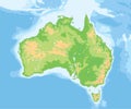
High detailed Australia physical map.
Political Oceania Map vector illustration with countries in white color
Political blank World Map vector illustration with different tones of yellow for each country.
Political Asia Map vector illustration. Editable and clearly lab
Highly detailed political map of the World.
Political South America Map vector illustration isolated on white background with country names in spanish
Vector map of China with provinces, regions and administrative divisions, and neighbouring countries.
Political World Map vector illustration with different tones of yellow for each country and country names in german.
Political World Map vector illustration with different tones of green for each country.
Stylized map of Namibia. Isometric 3D
Political blank Asia Map vector illustration isolated on white background.
High detailed Australia physical map.
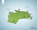
Stylized map of Australia.
Political Europe Map vector illustration with different colors for each country
USA Map vector illustration with country names in spanish
In the starry night sky, the Milky Way is clearly visible, and there is a sparkling magical path on the suburban grassland.
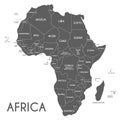
Political Africa Map vector illustration isolated on white background with country names in spanish
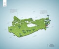
Stylized map of Canada. Isometric 3D
Next Page
←
↑
↓
→
See more images