Search
(+)
cartoon
dealer
buy stock illustrations
Home
My rookie portfolio
📷 Upload yours 🤳
Find results that contain
all
of your keywords. Content filter is
on
. Search will return
best illustrations, stock vectors and clipart
.
Exclude
Make it so!
You have chosen to exclude "
" from your results.
Choose orientation:
Related commercial searches:
vector
regional
blank
map
bulgaria
provinces
administrative
divisions
neighbouring
countries
territories
switzerland
cantons
honduras
departments
slovakia
slovak
republic
regions
guatemala
Page
of 424
←
→
Order by:
relevancy of keywords
|
publishing date
|
most downloaded
Territories
Cartoons, Illustrations & Vector Stock Images
- 11445 images
Vector regional blank map of Bulgaria with provinces and administrative divisions, and neighbouring countries and territories.
Vector regional blank map of Switzerland with cantons and administrative divisions, and neighbouring countries and territories.
Vector regional blank map of Honduras with departments and administrative divisions, and neighbouring countries and territories.
Vector map of Slovakia or Slovak Republic with regions and administrative divisions, and neighbouring countries and territories.
Vector regional blank map of Guatemala with departments and administrative divisions, and neighbouring countries and territories.
Vector illustrated regional map of Belize with districts and administrative divisions, and neighbouring countries and territories
Vector illustrated regional map of Hungary with counties and administrative divisions, and neighbouring countries and territories
Vector illustrated regional map of Romania with counties and administrative divisions, and neighbouring countries and territories
Vector regional blank map of Austria with federal states and administrative divisions, and neighbouring countries and territories
Vector regional blank map of El Salvador with departments and administrative divisions, and neighbouring countries and territories
Districts okresy of Slovakia colored by regions vector map with neighbouring countries and territories
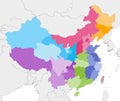
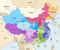
Vector map of China provinces colored by regions with neighbouring countries and territories
Spain autonomous communities and provinces vector map with neighbour countries and territories
North africa - maps of territories - vector
Map of Northwest Territories on white background. map of the Northwest Territories Canada. outline map of Northwest Territories.
Municipalities of North Macedonia colored by regions with neighbouring countries and territories vector map
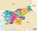
Municipalities of Slovenia colored by statistical regions vector map with neighbouring countries and territories
Indian Union Territories icons set single stroke vector
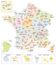
Administrative map of the 13 regions of France and overseas territories
Freehand map : British Overseas Territories
Cyprus regions vector map with neighbouring countries and territories
Modern agricultural machine, vehicle for cleaning, watering fields and territories.
Canadian map with short provinces and territories names. Canada background. Vector illustration
Turkey provinces and districts vector map with neighbouring countries and territories
Northwest Territories outline map
Tadzhikistan Territories outline map
Next Page
←
↑
↓
→
See more images