Search
(+)
cartoon
dealer
buy stock illustrations
Home
My rookie portfolio
📷 Upload yours 🤳
Find results that contain
all
of your keywords. Content filter is
on
. Search will return
best illustrations, stock vectors and clipart
.
Exclude
Make it so!
You have chosen to exclude "
" from your results.
Choose orientation:
Related commercial searches:
map
city
central
park
geographical
location
navigation
tourist
urban
chart
mega
sale
back
to
school
discount
banner
cute
cartoon
girl
holding
globe
student
fair
event
africa
drawn
illustrated
brush
strokes
physics
cartography
atlas
colorful
europe
representation
encapsulates
rich
tapestry
nations
Page
of 741
←
→
Order by:
relevancy of keywords
|
publishing date
|
most downloaded
Geographical
Cartoons, Illustrations & Vector Stock Images
- 77655 images
Map of The City Central Park. Geographical Location and Navigation tourist urban chart.
Mega Sale, Back to School Discount Banner with Cute Cartoon Girl Holding Geographical Globe. Student Fair Event Discount
Map of Africa, drawn illustrated brush strokes, geographical map, physics. Cartography, geographical atlas
A colorful map of Europe is a geographical representation that encapsulates the rich tapestry of nations
Stylized map of North America with indigenous animals and nature symbols. Simple geographical map. Flat vector
Map of The City. Navigation Tourist Guide, Route Urban Chart, Geographical Location. (Grunge Vintage Remake).
Creative Representation of a World Map Made From Pink Spheres, Showcasing Geographical Diversity
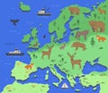
Stylized map of Europe with indigenous animals and nature symbols. Simple geographical map. Flat vector illustration
sketching style of the map Pakistan. An abstract image for a geographical design, pak, pk , Islamic republic of Pakistan
School teacher using laptop at geography lesson. Lecturer leans on desk with hanging paper geographical map of globe in
Illustration of a generic geographical map part
Geographical globe of planet Earth, 3D rendering
Antique treasure map icon vector flat illustration. Ancient drawing of way geographical navigation
World map, hand drawn, illustrated brushstrokes, geographical map
Map of The City. Geographical Location, Navigation Tourist Guide, Route Urban Chart.
Map of Africa, white geographical map, physics. Cartography, geographical atlas
Old geographical map of the world of the 18 century. Collage. A good background for design on the theme of travel, geography,
Interactive Global Map Footage Showcasing Geographical Data and Movement
World Map Represents Geographical Continents And Template
Globe map of Asia, satellite view, geographical map, physics. Cartography, China, South Korea
Location Icon, Map, Address, Geographical Position
Old geographical globe in cabinet with bookselfs. Science, education, travel, vintage background. History and geography team.
Stylized Africa map with indigenous animals and nature symbols. Simple geographical map. Flat vector illustration
A folded paper map displays roads and geographical features, marked with
Next Page
←
↑
↓
→
See more images