Search
(+)
cartoon
dealer
buy stock illustrations
Home
My rookie portfolio
📷 Upload yours 🤳
Find results that contain
all
of your keywords. Content filter is
on
. Search will return
best illustrations, stock vectors and clipart
.
Exclude
Make it so!
You have chosen to exclude "
" from your results.
Choose orientation:
Explore cartoons & images using related keywords:
afghanistan
africa
algeria
arabia
benin
blue
bulgaria
cameroon
capital
chad
cities
city
country
detailed
egypt
equipment
ethiopia
france
geographical
geography
ghana
greece
guinea
illustration
iran
iraq
italy
jordan
land
libya
locations
mali
map
mauritania
morocco
navigational
niger
nigeria
north
oman
pakistan
political
regions
sahara
saudi
senegal
somali
spain
sudan
syria
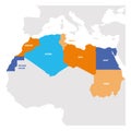
North Africa Map - Vector Illustration Stock Photo
Download
Designed by
Dikobrazik
Title
North Africa Map - Vector Illustration #100356642
Description
North Africa Map - Detailed Vector Illustration
Earth - North Africa & Sahara
Middle East And North Africa Uprisings
Europe and North Africa city lights map
North Africa and Middle East political map
North Africa countries political map
North Africa and Middle East political map
North Africa countries political map
Mediterranean Basin Political Map
World Map Detailed Physical Map
Map of World. Political map divided to six continents - North America, South America, Africa, Europe, Asia and Australia
Colorful grunge Hamsa or Fatima Hand palm-shaped amulet, used as sign of protection in Middle East and North Africa
North Africa Region. Map of countries in northern Africa. Vector illustration
World Map of MEDITERRANEAN REGION: Southern Europe, Middle East, North Africa. (Geographic chart).
Print. Vector map of the world with cartoon animals for kids.