Search
(+)
cartoon
dealer
buy stock illustrations
Home
Black Friday
Find results that contain
all
of your keywords. Content filter is
on
. Search will return
best illustrations, stock vectors and clipart
.
Exclude
Make it so!
You have chosen to exclude "
" from your results.
Choose orientation:
Explore cartoons & images using related keywords:
background
blank
border
boundary
canada
contour
design
detailed
empty
isolated
manitoba
map
outline
pattern
province
set
silhouette
state
territory
travel
vector
winnipeg
Manitoba Blank Outline Map Set Cartoon Vector
Download
Designed by
Davidzydd
Title
Manitoba blank outline map set #102210895
Description
Manitoba province blank vector outline map set
Manitoba map outline
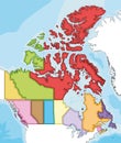
Map of Canada divided into 10 provinces and 3 territories. Administrative regions of Canada. Blank multicolored map
Blank map of Canada divided into 10 provinces and 3 territories. Administrative regions of Canada. Solid grey vector map
Map of Canada divided into 10 provinces and 3 territories. Administrative regions of Canada. Blank white map with black
Flag of Manitoba from brush strokes. Blank map of Manitoba. Canada. High quality map of Manitoba and flag on transparent backgrou
Manitoba map on transparent background. Province of Manitoba map with municipalities in gray for your web site design, logo, app,
Locator map of MANITOBA, CANADA
Gray map of MANITOBA, CANADA
Black map of MANITOBA, CANADA
Vector blank map of Canada with provinces and territories and administrative divisions, and neighbouring countries and territories
Vector blank map of Canada with provinces and territories and administrative divisions.
Vector illustrated blank map of Canada with provinces and territories and administrative divisions, and neighbouring countries
Manitoba state map lettering in map shape. Manitoba typography map with black and white color
Manitoba outline map