Search
(+)
cartoon
dealer
buy stock illustrations
Home
My rookie portfolio
📷 Upload yours 🤳
Find results that contain
all
of your keywords. Content filter is
on
. Search will return
best illustrations, stock vectors and clipart
.
Exclude
Make it so!
You have chosen to exclude "
" from your results.
Choose orientation:
Explore cartoons & images using related keywords:
andaman
asia
atlas
bangkok
cartography
chang
climate
coastline
geography
gulf
indochina
island
khai
krabi
kut
malacca
map
mekong
nong
pattaya
phangan
phuket
political
samui
sea
siam
songkhla
strait
tarutao
thailand
trang
travel
tropical
Thailand Political Map Cartoon Vector
Download
Designed by
Peterhermesfurian
Title
Thailand Political Map #103523023
Description
Thailand Political Map with capital Bangkok, national borders, most important cities, rivers and lakes. English labeling and scaling. Illustration.
Thailand political map
Thailand political map divide by state colorful outline simplicity style
Thailand political map, from Ko Tao and Ko Samui to Phuket
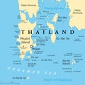
Phuket, largest Island of Thailand, political map with surrounding area
Thailand political map of administrative divisions
Colorful Thailand political map with clearly labeled, separated layers.
Thailand political map of administrative divisions