Search
(+)
cartoon
dealer
buy stock illustrations
Home
My rookie portfolio
📷 Upload yours 🤳
Find results that contain
all
of your keywords. Content filter is
on
. Search will return
best illustrations, stock vectors and clipart
.
Exclude
Make it so!
You have chosen to exclude "
" from your results.
Choose orientation:
Explore cartoons & images using related keywords:
blue
continent
countries
cut
cutting
digitally
dimensional
europe
generated
generic
geographical
geography
horizontal
illustration
image
land
location
mainland
map
object
out
people
physical
shape
simplicity
single
spheres
stylized
three
Europe 3D Map Illustration Continent
Download
Designed by
Nelsonaishikawa
Title
Europe 3D map illustration continent #103655656
Description
Europe 3D map illustration continent mainland countries geographical location land geography cut
Map of Europe illustration
3d Europe Illustration
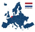
Illustration of a map of Europe with highlighted Netherlands
Grey political map of Europe. Europe map illustration. Political Europe map.
Oil crisis and economy crisis after pandemic coronavirus in China, Usa and Europe. Illustration vith covid19 concept.
COVID-19 coronavirus in Europe, illustration with corona virus icon and inscription Stop on global map. World economy hits by
Travel famous landmarks world, Europe, Asia and America. Watercolor landscape
3D little people standing on the map of Europe. 3D illustration
Fantasy drawing of old stone castle from fairyland. Medieval kingdom. Middle ages in Western Europe. Illustration for kids fairy
Fantasy drawing of old Gothic castle with stained glass windows. Medieval kingdom. Middle ages in Western Europe. Illustration for
Fantasy drawing of Gothic castle with stained glass windows. Medieval kingdom. Middle ages in Europe. Illustration for kids fairy
3D Realistic Cloudy World Globe Europe Illustration black Background
3D Realistic Cloudy World Globe Europe Illustration White Background