Search
(+)
cartoon
dealer
buy stock illustrations
Home
Black Friday
Find results that contain
all
of your keywords. Content filter is
on
. Search will return
stock photos and royalty free images
.
Exclude
Make it so!
You have chosen to exclude "
" from your results.
Choose orientation:
Explore cartoons & images using related keywords:
antrim
armagh
carlow
city
clare
connacht
cork
county
derry
donegal
dublin
dun
fermanagh
fingal
flag
galway
geography
icon
ireland
kerry
kidare
kilkenny
laoghaire
laois
leinster
leitrim
limerick
londonderry
longford
louth
map
mayo
meath
monaghan
munster
northern
province
rathdown
republic
roscommon
sligo
travel
tripperary
tyrone
ulster
vector
waterford
westmeath
wexford
Provinces And Counties Of Ireland Vector Map
Download
Designed by
Jktu21
Title
Provinces and counties of Ireland vector map #103733740
Description
Provinces and counties of the Ireland island map vector illustration
Editable blank vector map of China. Administrative divisions of China counties, separated provinces.
Administrative divisions of Mexico counties, separated provinces. Mexico map .
Spain Provinces map - High detailed Black map with counties/regions/states of Spain Provinces. Spain Provinces map isolated on
Set of vector icons. Regions of Ireland flags, provinces and counties.
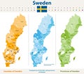
Vector maps of Sweden counties and provinces
spain Provinces map - High detailed blue map with counties/regions/states of spain Provinces. spain Provinces map isolated on
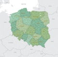
Detailed map of Poland with administrative divisions into 16 provinces voivodeships and counties powiats, major cities of the
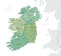
Detailed map of Ireland with administrative divisions into provinces and counties, major cities of the country, vector
Vector color detailed map of Ireland with administrative divisions of the country, each provinces is presented separately in-
Provinces of Ireland map. Detailed outline and silhouette. Administrative divisions and counties. Set of vector maps. All isolated
Vector color detailed map of Poland with administrative divisions of the country, each provinces voivodeships is presented
Infographic map of Poland with administrative division into 16 provinces voivodeships and counties powiats
Modern White Map of Cuba with Provinces with Counties With Shadow
Modern White Map of Costa Rica with Provinces with Counties With Shadow