Search
(+)
cartoon
dealer
buy stock illustrations
Home
My rookie portfolio
📷 Upload yours 🤳
Find results that contain
all
of your keywords. Content filter is
on
. Search will return
best illustrations, stock vectors and clipart
.
Exclude
Make it so!
You have chosen to exclude "
" from your results.
Choose orientation:
Explore cartoons & images using related keywords:
abstract
africa
annobon
atlantic
atlas
biafra
bight
bioko
cameroon
cartography
coastline
corisco
country
elobey
equator
equatorial
fernando
gabon
geography
guinea
gulf
illustration
island
islands
malabo
map
mbane
mbini
ocean
political
republic
travel
west
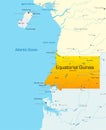
Equatorial Guinea Political Map Cartoon Vector
Download
Designed by
Peterhermesfurian
Title
Equatorial Guinea Political Map #103735273
Description
Equatorial Guinea Political Map with capital Malabo, national borders, important cities and rivers. English labeling and scaling. Illustration.
Equatorial Guinea
Equatorial Guinea map
Equatorial Guinea world map with a pixel diamond texture.
Equatorial Guinea country design template Flat car
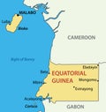
Republic of Equatorial Guinea - vector map
Equatorial Guinea political map
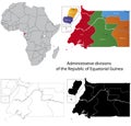
Map of Equatorial Guinea with black contour lines
Vector road and national park map of equatorial guinea
Bioko, island and northernmost part of Equatorial Guinea, political map
Equatorial Guinea map collection. Borders of Equatorial Guinea for your infographic
Calendar 2031 Spanish language with Equatorial Guinea public holidays. Week starts from Sunday.
Bioko, island and part of Equatorial Guinea, gray political map