Search
(+)
cartoon
dealer
buy stock illustrations
Home
Black Friday
Find results that contain
all
of your keywords. Content filter is
on
. Search will return
best illustrations, stock vectors and clipart
.
Exclude
Make it so!
You have chosen to exclude "
" from your results.
Choose orientation:
Explore cartoons & images using related keywords:
abstract
americas
antilles
atlas
capital
caribbean
cartography
case
climate
coastline
cruise
destination
dutch
europe
france
friendly
geography
grand
ground
ilet
illustration
island
islands
leeward
lesser
maarten
map
marigot
martin
netherlands
philipsburg
pinel
political
rambaud
saint
sandy
sint
sxm
travel
tropical
Saint-Martin Country Political Map Vector Illustration
Download
Designed by
Peterhermesfurian
Title
Saint-Martin Country Political Map #104231886
Description
Saint-Martin Country Political Map. The northern part of the caribbean island Saint Martin. An overseas collectivity of France with the capital Marigot, and important places. English labeling and scaling. Illustration.
Church saint Martin
Caribbean island of Saint Martin map
Canal Saint Martin
Saint Martin island political map
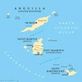
Anguilla, Saint-Martin, Sint Maarten and Saint Barthelemy map
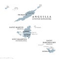
Anguilla, Saint-Martin, Sint Maarten and Saint Barthelemy political map
Saint Martin Island Political Map
Saint Martin map.
Saint Martin island highly detailed physical map
Saint Martin outline map
Saint Martin Island. Netherlands, France. Physical
Shape of Saint Martin Island. Netherlands, France. Yellow
Saint Martin Island. Netherlands, France. Bilevel
Saint Martin Island. Netherlands, France. Topo standard