Search
(+)
cartoon
dealer
buy stock illustrations
Home
My rookie portfolio
📷 Upload yours 🤳
Find results that contain
all
of your keywords. Content filter is
on
. Search will return
best illustrations, stock vectors and clipart
.
Exclude
Make it so!
You have chosen to exclude "
" from your results.
Choose orientation:
Explore cartoons & images using related keywords:
administrative
area
border
borders
bourgogne
burgundy
cartography
city
counties
countries
country
county
department
departments
design
districts
division
divisions
flat
flats
fr
france
geography
graphic
icon
illustration
illustrations
land
map
modern
new
provinces
region
regional
regions
shape
silhouette
simple
state
states
territory
travel
trip
Modern Map - Bourgogne France FR Stock Illustration
Download
Designed by
Werbeantrieb
Title
Modern Map - Bourgogne France FR #104522917
Description
Modern Map - Bourgogne France FR illustration
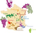
Map french wine.
Hauts-de-France - Grand Est - Bourgogne - Auvergne - Provence Map
Pays de la loire - Centre - Paris - Bourgogne - Franche Comte Map
Paris - Grand Est - Centre - Val de Loire - Bourgogne Map France
Paris - Centre - Bourgogne - Auvergne - Provence Map France
Bourgogne map with French national flag illustration
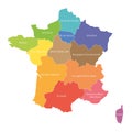
Regions of France. Map of regional country administrative divisions. Colorful vector illustration
Virtual reality fried escargot in a cartoon hot pan
Bourgogne - Franche-Comte red highlighted in map of France
French coats of arms
Glossy glass Flag of Modern Prussia
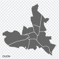
High Quality map of Dijon is a city The France, with borders of the regions. Map Dijon of Bourgogne-Franche-Comte
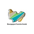
Map City of Bourgogne Franche Comte, Vector isolated illustration of simplified administrative map of France. Borders and names of
France region silhouettes set and blank map of the country isolated on white background.