Search
(+)
cartoon
dealer
buy stock illustrations
Home
My rookie portfolio
📷 Upload yours 🤳
Find results that contain
all
of your keywords. Content filter is
on
. Search will return
best illustrations, stock vectors and clipart
.
Exclude
Make it so!
You have chosen to exclude "
" from your results.
Choose orientation:
Explore cartoons & images using related keywords:
abstract
adriatic
aegean
africa
atlas
balearic
basin
cartography
coastline
country
cruise
cyclades
destination
dodecanese
east
europe
geography
illustration
island
land
maghreb
map
mediterranean
middle
political
region
sea
south
state
travel
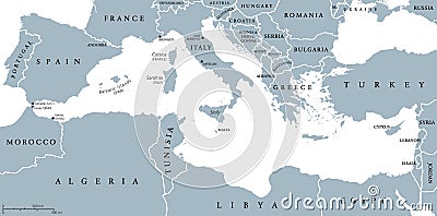
Mediterranean Sea Region Countries Map Vector Illustration
Download
Designed by
Peterhermesfurian
Title
Mediterranean Sea region countries map #105224892
Description
Mediterranean Sea region countries political map with national borders. South Europe, North Africa and Near East with national borders. English labeling and scaling. Illustration.
Mediterranean region
Mediterranean Sea Region Political Map
Mediterranean region watercolor map of Turkey in front of a white background
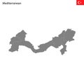
Vector isolated simplified map of Turkey regions. Marked Mediterranean Region. Borders and names of administrative divisions.
World Map of MEDITERRANEAN REGION: Southern Europe, Middle East, North Africa. (Geographic chart).
Mediterranean Region red highlighted in map of Turkey
Antalya City Republic of Turkey, Mediterranean Region map vector illustration, scribble sketch City of Antalya map
High Quality map Mediterranean region of Turkey, with borders
High resolution detailed map of Mediterranean region
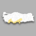
Mediterranean region location within Turkey map
3d isometric map Mediterranean Region of Turkey
Fresh olive branch with ripe olives isolated on white background. Healthy organic fruit from Mediterranean region. High quality
Olive harvesting process mediterranean region food photography natural setting close-up view culinary art, national olive day