Search
(+)
cartoon
dealer
buy stock illustrations
Home
My rookie portfolio
📷 Upload yours 🤳
Find results that contain
all
of your keywords. Content filter is
on
. Search will return
best illustrations, stock vectors and clipart
.
Exclude
Make it so!
You have chosen to exclude "
" from your results.
Choose orientation:
Explore cartoons & images using related keywords:
abstract
administrative
area
atlas
background
border
cartography
central
continent
contour
country
detailed
district
division
eu
europe
finland
geographical
geography
gray
hame
icon
illustration
karelia
kexholm
kymmenegard
kymmenegrd
land
layout
mainland
map
mapping
nation
national
nyslott
origin
ostrobothnia
oulu
pori
province
region
regions
savolax
silhouette
state
surface
territory
topography
turku
uusimaa
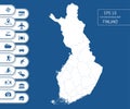
The Detailed Map Of The Finland With Regions Vector Illustration
Download
Designed by
Panya85
Title
The detailed map of the Finland with regions #105414920
Description
The detailed map of the Finland with regions. Vector illustration
Detailed Finland Map. No text
Detailed Finland Map.
High detailed Finland road map with labeling.
Highly Detailed Finland Silhouette map.
High detailed Finland physical map with labeling.
High detailed Finland physical map.
High detailed Finland physical map with labeling.
High detailed Finland physical map.
Flat high detailed Finland map. Divided into editable contours of administrative divisions. Vacation and travel icons.
Realistic 3d Detailed Finland Flag Banner Set. Vector
Realistic 3d Detailed Finland Flag on Flagpole. Vector
Realistic 3d Detailed Finland Independence Day Background. Vector