Search
(+)
cartoon
dealer
buy stock illustrations
Home
My rookie portfolio
📷 Upload yours 🤳
Find results that contain
all
of your keywords. Content filter is
on
. Search will return
best illustrations, stock vectors and clipart
.
Exclude
Make it so!
You have chosen to exclude "
" from your results.
Choose orientation:
Explore cartoons & images using related keywords:
atlas
avarua
black
border
chart
cook
country
democratic
design
detailed
foreigner
geo
geography
government
graphic
high
homeland
illustration
information
islander
islands
isolated
journey
location
map
national
navigation
new
oceania
outline
patriotic
politics
polynesia
region
republican
sea
silhouette
symbol
topography
tourist
transportation
travel
traveler
trotter
trotting
vector
voyage
world
zealand
Cook Islands Map. Cartoon Vector
Download
Designed by
Gagarych
Title
Cook Islands map. #111019229
Description
Cook Islands map. Island silhouette icon. Isolated Cook Islands black map outline. Vector illustration.
Vector money gold coin Cook Islands Dollar
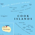
Cook Islands political map with capital Avarua
Cook Islands gray political map with capital Avarua
Vector map of the Pacific volcanic island of Rarotonga, Cook Islands
Enuamanu Island. Cook Islands. Location diagram. Yellow
Welcome to Cook Islands stamp. Cook Islands round sign
Abstract map of the island Aitutaki (Cook Islands)
Abstract map of the island Mangaia (Cook Islands)
Abstract map of the island Mauke (Cook Islands)
Abstract map of the island Atiu (Cook Islands)
Abstract map of the island Mitiaro (Cook Islands)
Abstract map of the island Rarotonga (Cook Islands)
Detailed road map of the volcanic island of Rarotonga, Cook Islands
Welcome to Cook Islands stamp. Cook Islands round sign