Search
(+)
cartoon
dealer
buy stock illustrations
Home
My rookie portfolio
📷 Upload yours 🤳
Find results that contain
all
of your keywords. Content filter is
on
. Search will return
best illustrations, stock vectors and clipart
.
Exclude
Make it so!
You have chosen to exclude "
" from your results.
Choose orientation:
Explore cartoons & images using related keywords:
america
cartography
country
file
geography
illustration
map
nation
northwest
olympia
pacific
region
seattle
silhouette
state
states
territory
travel
united
usa
vector
washington
Washington State Map - State In The Pacific Northwest Region Of The United States Vector Illustration
Download
Designed by
Velickovicvlada
Title
Washington State map - state in the Pacific Northwest region of the United States #111151722
Description
Vector file of Washington State map - state in the Pacific Northwest region of the United States
Washington state detailed map
Washington State Capitol, Olympia
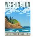
Washington State travel poster of rugged shoreline and lighthouse.
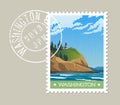
Washington State postage stamp design of rugged shoreline and lighthouse.
Washington State Capitol in Olympia, United States
Hand Drawn Washington State Sketch
Washington State map - state in the Pacific Northwest region of the United States
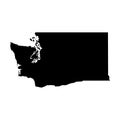
Washington State map silhouette.
Washington, state of USA - solid black silhouette map of country area. Simple flat vector illustration
Washington state map with its neighboring states
The Mount St Helens National Volcanic Monument Within Gifford Pinchot National Forest in Washington State WPA Poster Art
Mount Rainier Viewed from Cowlitz Divide Along the Wonderland Trail Located in Mount Rainier National Park in Washington State WPA
South Face of Mount Rainier Tahoma or Tacoma with Kautz Ice Cliff Located in Mount Rainier National Park Washington State WPA