Search
(+)
cartoon
dealer
buy stock illustrations
Home
Black Friday
Find results that contain
all
of your keywords. Content filter is
on
. Search will return
best illustrations, stock vectors and clipart
.
Exclude
Make it so!
You have chosen to exclude "
" from your results.
Choose orientation:
Explore cartoons & images using related keywords:
administrative
area
atlantic
background
black
border
cartography
city
continent
contour
country
denmark
destination
detailed
direction
district
eps
europe
faroe
flat
geography
government
gps
high
icon
illustration
islands
isolated
location
map
mark
marker
metropolis
nation
navigation
north
outline
pin
place
point
pointer
political
province
region
silhouette
state
symbol
territory
travel
white
Faroe Islands Map Silhouette. Stock Illustration
Download
Designed by
Vsviracevic
Title
Faroe Islands map silhouette. #115889470
Description
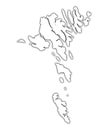
Faroe Islands map silhouette isolated on white background. High detailed silhouette illustration. Denmark territory. Europe state.
Faroe Islands outline map
Faroe Islands map
A collection of golden shapes from the European states European states Denmark, Estonia, Faroe Islands
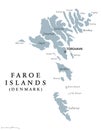
Faroe Islands political map
Faroe Islands map outline
Faroe Islands map vector
Faroe Islands Political Map
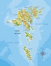
Faroe islands highly detailed physical map
Faroe Islands outline map
Shape of Boroy Island. Faroe Islands. Yellow
Shape of Sandoy Island. Faroe Islands. Yellow
Shape of Vagar Island. Faroe Islands. Yellow
Panorama of Klaksvik city on Faroe islands
Faroe Islands, Beautiful view at islands, Saksun is a village near the northwest coast of the Faroese island of Streymoy, in Sunda
3D Isometric Map Highlighting Faroe Islands in Red