Search
(+)
cartoon
dealer
buy stock illustrations
Home
My rookie portfolio
📷 Upload yours 🤳
Find results that contain
all
of your keywords. Content filter is
on
. Search will return
best illustrations, stock vectors and clipart
.
Exclude
Make it so!
You have chosen to exclude "
" from your results.
Choose orientation:
Explore cartoons & images using related keywords:
america
atlas
background
bitmap
borders
boundary
button
chart
clipping
continent
countries
country
cut
cutout
design
detail
diagram
digital
elements
fill
geographic
geography
graphic
green
icon
illustrated
illustration
isolated
landmark
mapping
maps
mask
mercator
nation
national
outline
set
shape
silhouette
south
surface
symbol
territory
white
South America Maps Royalty-Free Stock Photo
Download
Designed by
Speedfighter17
Title
South America Maps #12269817
Description
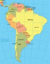
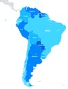
Set of maps of South America isolated on white background.
South America
Political map of South America
Map of South America illustration
South America political map
3D south america map on white
South America Map
Vintage South America Map
North and South America high detailed vector political map
The Americas, North and South America, political map
North and South America Political Map Isolated On White. No text
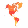
Vector South America and North America map with countries borders. Abstract red and yellow American countries on map
South America map - monochrome shape. Vector.
South America Map
South America map
World Map of SOUTH AMERICA: Latin America, Argentina, Brazil, Peru, Patagonia, Amazon River. Geographic chart.