Search
(+)
cartoon
dealer
buy stock illustrations
Home
My rookie portfolio
📷 Upload yours 🤳
Find results that contain
all
of your keywords. Content filter is
on
. Search will return
stock photos and royalty free images
.
Exclude
Make it so!
You have chosen to exclude "
" from your results.
Choose orientation:
Explore cartoons & images using related keywords:
area
background
bright
caribbean
country
design
download
eustatius
geography
high
illustration
island
light
map
mono
monochrome
netherlands
ocean
outline
plan
print
printable
quality
road
roads
scalable
sea
sint
street
streets
texture
tourist
traffic
travel
trip
urban
vacation
vector
white
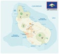
Map Of Sint Eustatius Island Vector Illustration
Download
Designed by
Netsign33
Title
Map of Sint Eustatius Island #123385102
Description
Map of Sint Eustatius Island,ÃÂ Caribbean Netherlands, contains geography outlines for land mass, water, major roads and minor roads.
Sint Eustatius map
Sint Eustatius map
Sint Eustatius map of polygonal mosaic lines network, rays and space stars illustration.
Sint Eustatius map of polygonal mosaic lines network, rays, dots vector illustration.
Sint Eustatius road and national park map with flagai
Sint Eustatius road and national park vector map
3D Sint Eustatius coat of arms.
Sint Eustatius official national flag and coat of arms, caribbean
Sint Eustatius island Kingdom of the Netherlands, Netherlands Antilles, Cenrtal America, Caribbean islands map vector
Golden 3D Sint Eustatius inscription isolated on white background
Stamp Postal of Sint Eustatius island. Map Silhouette rubber Seal. Design Retro Travel. Seal Map of Sint Eustatius grunge