Search
(+)
cartoon
dealer
buy stock illustrations
Home
My rookie portfolio
📷 Upload yours 🤳
Find results that contain
all
of your keywords. Content filter is
on
. Search will return
stock photos and royalty free images
.
Exclude
Make it so!
You have chosen to exclude "
" from your results.
Choose orientation:
Explore cartoons & images using related keywords:
adriatic
cartography
cres
croatia
europe
geography
gulf
istria
istrian
krk
kvarner
map
mediterranean
peninsula
relief
rijeka
sea
shaded
terrain
topographic
topography
Istria Map Stock Image
Download
Designed by
Intrepix
Title
Istria Map #12343129
Description
A map with shaded relief and hypsometric tints showing the Istrian peninsula and the Kvarner Gulf in Croatia.
Flag of Istria County, Croatia.
Istria County Counties of Croatia, Republic of Croatia map vector illustration, scribble sketch Istria map
Bale, in Istria, Croatia, during the 1890s, vintage engraving
Istria County Counties of Croatia, Republic of Croatia map vector illustration, scribble sketch Istria map
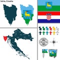
Map of Istria, Croatia
Flag of Pazin in Istria County of Croatia
Location Map of Istria County
Vector map of the Croatian peninsula Istria, Croatia
Matthias Flacius 1520-1575 was a Lutheran reformer from Istria. Christian figure
Acrylic Painting of Rovinj Istria Croatia.
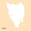
High Quality map of Istria is a region of Croatia
Aerial view of Gologorica old town, located on the top of a hill. Typical landscape of Central Istria,
Cityscape of Rovinj, Istria, Croatia Generative AI
3d isometric map of Istria is a county of Croatia