Search
(+)
cartoon
dealer
buy stock illustrations
Home
My rookie portfolio
📷 Upload yours 🤳
Find results that contain
all
of your keywords. Content filter is
on
. Search will return
best illustrations, stock vectors and clipart
.
Exclude
Make it so!
You have chosen to exclude "
" from your results.
Choose orientation:
Explore cartoons & images using related keywords:
alaska
america
american
background
blank
border
brown
card
character
continent
country
design
earth
frame
green
hawaii
hawaiian
icon
icons
illustration
image
individual
infographics
map
natural
nature
object
orange
outline
paper
papery
poster
separated
sign
silhouette
state
states
template
text
texture
travel
united
usa
vector
wallpaper
world
USA With Alaska And Hawaii Map With Individual States Separated, Infographics With Icons Vector Illustration
Download
Designed by
Mondih
Title
USA with Alaska and Hawaii map with individual states separated, infographics with icons #132070766
Description
USA with Alaska and Hawaii map with individual states separated, infographics with icons vector
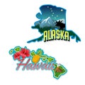
Alaska, Hawaii retro state facts illustrations
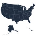
Map of the American continent and the USA including Alaska and Hawaii. Blank similar USA map on white background.
The detailed map of the USA including Alaska and Hawaii. The United States of America
Detailed map of the American continent and the USA including Alaska and Hawaii. Vector illustration
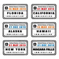
USA vector passport stamps
Vector posters with highly detailed silhouettes of maps of the states of America, Division Pacific - Alaska, Hawaii - set 17 of 17
Vector posters states of the United States with a name, nickname, date admitted to the Union, Division Pacific - Alaska, Hawaii -
Typography composition of city names, silhouettes maps of the states of America, vector detailed posters, Division Pacific -
Vector posters detailed silhouettes maps of the states of America with abstract linear pattern, Division Pacific - Alaska, Hawaii
Map depicting the United States with altered state names and labeled time zones.
Map of the United States divided into fictional regions with an illustrated road network.
U.S. map using a gradient color scheme to show population density, with a scale
Map of the United States with fictional names for each state. The map uses a color
Map of the United States with alternative names for the states. States are colored
Abstract representation of the United States map, divided into states with a
AI-Generated Map of the United States