Find results that contain all of your keywords. Content filter is on.
Search will return best illustrations, stock vectors and clipart.
Choose orientation:
Make it so!
You have chosen to exclude "" from your results.
Choose orientation:
Explore cartoons & images using related keywords:
berkshire
borders
britain
buckinghamshire
cambridgeshire
cartography
ceremonial
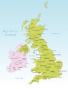
cheshire country county derbyshire devon divisions east england essex geography glasgow gloucestershire great greater hampshire hertfordshire ireland kent kingdom lancashire leicestershire london manchester map merseyside midlands norfolk north northern nottinghamshire oxfordshire scotland somerset south staffordshire suffolk surrey sussex travel tyne united vector walesUnited Kingdom Administrative Districts Vector High Detailed Map Colored By Regions And Counties
Designed by
Title
United Kingdom administrative districts vector high detailed map colored by regions and counties #133268634
Description


