Search
(+)
cartoon
dealer
buy stock illustrations
Home
My rookie portfolio
📷 Upload yours 🤳
Find results that contain
all
of your keywords. Content filter is
on
. Search will return
best illustrations, stock vectors and clipart
.
Exclude
Make it so!
You have chosen to exclude "
" from your results.
Choose orientation:
Explore cartoons & images using related keywords:
background
belgium
benelux
black
blue
border
dutch
europe
france
gray
green
holland
illustration
isolated
light
map
netherlands
provinces
red
sea
vector
white
yellow
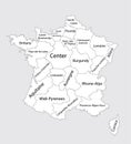
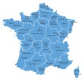
Map Of France With Provinces Vector Illustration
Download
Designed by
Momcilojovanov
Title
Map of France with provinces #135205948
Description
Vector illustration of the Map of France with provinces
France provinces maps
Administrative divisions of France, separated provinces.
Vector Map of France with Provinces and Major Cities
Map of France with provinces
France watercolor map vector illustration of blue color with border lines of different regions or provinces on light background
France watercolor map vector illustration of green color with border lines of different regions or provinces on light background