Search
(+)
cartoon
dealer
buy stock illustrations
Home
My rookie portfolio
📷 Upload yours 🤳
Find results that contain
all
of your keywords. Content filter is
on
. Search will return
best illustrations, stock vectors and clipart
.
Exclude
Make it so!
You have chosen to exclude "
" from your results.
Choose orientation:
Explore cartoons & images using related keywords:
america
banner
black
canada
canadian
cartography
contour
country
easterly
file
flag
illustration
labrador
land
leaf
map
most
nation
new
newfoundland
north
province
red
region
sign
silhouette
topography
travel
vector
white
world
Newfoundland And Labrador Map With Canadian Flag - The Most Easterly Province Of Canada Cartoon Vector
Download
Designed by
Velickovicvlada
Title
Newfoundland and Labrador map with Canadian flag - the most easterly province of Canada #135676709
Description
Vector file of Newfoundland and Labrador map with Canadian flag - the most easterly province of Canada
Map of Newfoundland and Labrador
Map of Newfoundland and Labrador with rivers and lakes.
3D Map of Newfoundland & Labrador - Canada
Map of Newfoundland and Labrador on rusty metal
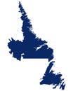
Map of Newfoundland and Labrador in blue colour
Flag and silhouette of the Newfoundland and Labrador vector
Map of Newfoundland and Labrador on dark slate
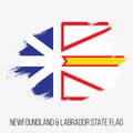
Canada Province Newfoundland Labrador State Vector Flag Design Template. Newfoundland Labrador State Flag for Independence Day
Green Hills and Tranquil Waters: A Vibrant Abstract of Newfoundland and Labrador, Canada
Panoramic landscape of Gros Morne National Park, Newfoundland, Labrador, Canada. Boardwalk on Tablelands Trail. Mountainous
Scenic boardwalk on Tablelands Trail in Gros Morne National Park, Newfoundland, Labrador, Canada. Rich green grass, wildflowers