Search
(+)
cartoon
dealer
buy stock illustrations
Home
My rookie portfolio
📷 Upload yours 🤳
Find results that contain
all
of your keywords. Content filter is
on
. Search will return
best illustrations, stock vectors and clipart
.
Exclude
Make it so!
You have chosen to exclude "
" from your results.
Choose orientation:
Explore cartoons & images using related keywords:
america
american
cartography
columbus
contour
country
file
great
illustration
lakes
map
maps
midwestern
ohio
ohioan
region
silhouette
state
states
territory
topography
travel
united
usa
vector
white
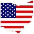
Ohio Map - Midwestern State In The Great Lakes Region Of The United States Vector Illustration
Download
Designed by
Velickovicvlada
Title
Ohio map - Midwestern state in the Great Lakes region of the United States #136349560
Description
Vector file of Ohio map - Midwestern state in the Great Lakes region of the United States
Ohio map - Midwestern state in the Great Lakes region of the United States
Ohio map with USA flag - Midwestern state in the Great Lakes region of the United States
Ohio map - Midwestern state in the Great Lakes region of the United States
Ohio maps with USA flag - Midwestern state in the Great Lakes region of the United States
Ohio map - Midwestern state in the Great Lakes region of the United States