Search
(+)
cartoon
dealer
buy stock illustrations
Home
My rookie portfolio
📷 Upload yours 🤳
Find results that contain
all
of your keywords. Content filter is
on
. Search will return
best illustrations, stock vectors and clipart
.
Exclude
Make it so!
You have chosen to exclude "
" from your results.
Choose orientation:
Explore cartoons & images using related keywords:
africa
aland
america
atlantic
background
border
borderline
continent
country
europe
grunge
grungy
illustration
islands
land
mainland
map
north
ocher
paper
red
retro
sea
state
umber
vintage
worn
Map Of North Atlantic Ocean - Aland Islands Stock Image
Download
Designed by
Tindoarchitect
Title
Map of North Atlantic Ocean - Aland Islands #149811181
Description
Aland Islands on the map of North Atlantic Ocean in soft grunge and vintage style, like old paper with watercolor painting
North Atlantic Ocean
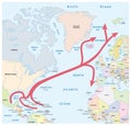
Map of the Gulf and North Atlantic stream in the Atlantic Ocean
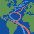
Gulf Stream North Atlantic Current
Hand drawn North Atlantic right whale
Map of the Gulf Stream and major North Atlantic Ocean currents
North Atlantic Ocean highlighted. Physical map
North Atlantic Ocean highlighted. Steel Blue map
North Atlantic Ocean, excluding sub-basins. Location. Bilevel ma
North Atlantic Ocean. Location. Bilevel map
North Atlantic Ocean. Location. Satellite map
North Atlantic Ocean, excluding sub-basins. Location. Satellite
North Atlantic Ocean on the world map. Patterned
North Atlantic Ocean on the world map. Solid
North Atlantic Ocean, excluding sub-basins. Bounding box. Steel