Find results that contain all of your keywords. Content filter is on.
Search will return best illustrations, stock vectors and clipart.
Choose orientation:
Make it so!
You have chosen to exclude "" from your results.
Choose orientation:
Explore cartoons & images using related keywords:
abstract
africa
asia
australia
background
cartography
continents
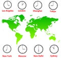
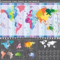
country difference earth europe exploration flat geography graphic illustration image map modern oceans pattern planes seas sending ships stuff symbol time timeline travel vector winter worldTime Zones On A World Map. Time Difference Between Countries In Winter. Illustrated Map Of The Earth. Cartoon Vector
Designed by
Title
Time zones on a world map. Time difference between countries in winter. Illustrated map of the earth. #158618059
Description


