Find results that contain all of your keywords. Content filter is on.
Search will return best illustrations, stock vectors and clipart.
Choose orientation:
Make it so!
You have chosen to exclude "" from your results.
Choose orientation:
Explore cartoons & images using related keywords:
administrative
area
background
black
border
borough
britain
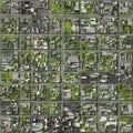
business capital cartography center city detailed district downtown england europe geography graphic guide information kingdom lines location london map merton metropolitan navigation place plan residential river roads southwark streets texture thames tourism tower town transportation travel united urban vector whiteSatellite View Of The London Boroughs, Map And Streets Of Merton Borough. England Cartoon Vector
Designed by
Title
Satellite view of the London boroughs, map and streets of Merton borough. England #161285177
Description


