Search
(+)
cartoon
dealer
buy stock illustrations
Home
My rookie portfolio
📷 Upload yours 🤳
Find results that contain
all
of your keywords. Content filter is
on
. Search will return
best illustrations, stock vectors and clipart
.
Exclude
Make it so!
You have chosen to exclude "
" from your results.
Choose orientation:
Explore cartoons & images using related keywords:
counties
map
ireland
relief
arms
border
coat
colorful
coronavirus
country
county
districts
europe
european
flag
flat
gray
greater
grey
labeled
north
province
provinces
regions
south
symbol
topographic
west
white
withing
Counties Map Of Ireland Cartoon Vector
Download
Designed by
Momcilojovanov
Title
Counties Map of Ireland #175466611
Description
Gray Counties Map of European Country of Ireland
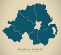
Modern Map - Northern Ireland with counties UK
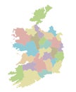
Vector map of Ireland. Republic of Ireland. Map of Ireland with the division into counties
Ireland watercolor map vector illustration of green color with border lines of different regions or counties on light background
Set of vector icons. Counties of Northern Ireland, Scotland and Wales flags.
County Dublin Republic of Ireland, Counties of Ireland map vector illustration, scribble sketch Dublin region map
Donegal County Council Republic of Ireland, Counties of Ireland map vector illustration, scribble sketch Donegal map
Counties Map of Ireland
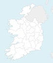
Vector blank map of Ireland with counties and administrative divisions, and neighbouring countries
Vector map of Ireland with counties and administrative divisions
Vector blank map of Ireland with counties and administrative divisions
Vector map of Ireland with counties and administrative divisions
Vector blank map of Ireland with counties and administrative divisions
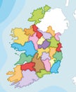
Vector illustrated map of Ireland with counties and administrative divisions, and neighbouring countries
Vector illustrated blank map of Ireland with counties and administrative divisions, and neighbouring countries