Search
(+)
cartoon
dealer
buy stock illustrations
Home
My rookie portfolio
📷 Upload yours 🤳
Find results that contain
all
of your keywords. Content filter is
on
. Search will return
best illustrations, stock vectors and clipart
.
Exclude
Make it so!
You have chosen to exclude "
" from your results.
Choose orientation:
Explore cartoons & images using related keywords:
1745
18th
abreu
america
antonio
canals
caribbean
cartography
century
chart
cities
colored
editorial
empire
gulf
handwritten
islands
madrid
mattos
mexico
museum
nautical
naval
nib
portulan
sea
south
spain
spanish
style
surrounding
territory
topography
watercolor
Nautical Chart Of The Caribbean Sea And Gulf Of Mexico, 1745 Editorial Image
Download
Designed by
Whpics
Title
Nautical Chart of the Caribbean Sea and Gulf of Mexico, 1745 #179439216
Description
Nautical Chart of the Caribbean Sea and Gulf of Mexico, 1745. By Antonio Abreu y Mattos. Naval Museum of Madrid, Spain
This image is editorial
Nautical chart-Dance drama ââ¬ÅThe Dream of Maritime Silk Roadââ¬Â
Admiralty chart agent shop
1492 Chart attributed to Christopher Columbus
1563 portulan chart of Mediterranean Sea
Nautical chart
Ancient nautical map of Israel
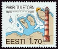
ESTONIA - CIRCA 1999: A stamp printed in Estonia shows Pakri Lighthouse and nautical chart, circa 1999.
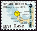
ESTONIA - CIRCA 2013: A stamp printed in Estonia shows Kiipsaare Lighthouse and nautical chart, circa 2013.
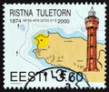
ESTONIA - CIRCA 2000: A stamp printed in Estonia shows Ristna Lighthouse and nautical chart, circa 2000.
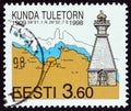
ESTONIA - CIRCA 1998: A stamp printed in Estonia shows Kunda Lighthouse and nautical chart, circa 1998.
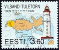
ESTONIA - CIRCA 1999: A stamp printed in Estonia shows Vilsandi Lighthouse and nautical chart, circa 1999.
ESTONIA - CIRCA 2002: A stamp printed in Estonia shows Laidunina Lighthouse and nautical chart, circa 2002.
Nautical chart showing the voyage of SV Estrellita, Wallace Island, Gulf Islands, British Columbia