Search
(+)
cartoon
dealer
buy stock illustrations
Home
My rookie portfolio
📷 Upload yours 🤳
Find results that contain
all
of your keywords. Content filter is
on
. Search will return
best illustrations, stock vectors and clipart
.
Exclude
Make it so!
You have chosen to exclude "
" from your results.
Choose orientation:
Explore cartoons & images using related keywords:
blue
business
capital
cities
city
computer
detailed
dublin
equipment
geographical
government
icon
illustration
ireland
irish
land
locations
map
navigational
painting
pointing
politics
regions
sign
symbol
vector
Ireland Map. Cities, Regions. Vector Stock Illustration
Download
Designed by
Dikobrazik
Title
Ireland map. Cities, regions. Vector #180161230
Description
Ireland map. Cities regions Vector illustration
Ireland map and cities
Grunge rubber stamp set
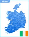
The detailed map of the Ireland with regions or states and cities, capitals, national flag
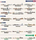
Largest cities skylines of British Isles countries: United Kingdom England, Wales, Scotland, Northern Ireland and Republic of Ir
Northern Ireland map with cities.
Detailed map of Ireland with administrative divisions into provinces and counties, major cities of the country, vector
Detailed map of Ireland with administrative divisions on dark background, country big cities and icons set, vector illustration
St. John Cathedral in Limerick, Ireland. Architectural symbols of European cities
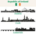
Republic of Ireland cities skylines silhouettes vector set
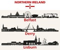
Northern Ireland cities skylines silhouettes vector set
Republic of Ireland cities outline skylines vector set
Scotland, Wales and Northern Ireland cities outline skylines vector set
Tagcloud of the most populous cities in Ireland
Ireland - detailed blue country map with cities, regions, location on world map and globe. Infographic icons
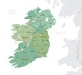
Ireland - detailed country map with cities and regions. Infographic icons