Search
(+)
cartoon
dealer
buy stock illustrations
Home
My rookie portfolio
📷 Upload yours 🤳
Find results that contain
all
of your keywords. Content filter is
on
. Search will return
best illustrations, stock vectors and clipart
.
Exclude
Make it so!
You have chosen to exclude "
" from your results.
Choose orientation:
Explore cartoons & images using related keywords:
abstract
administrative
alternative
area
black
border
brescia
capital
cartography
city
como
composition
country
county
creative
dark
design
europe
flat
geographical
geography
graphics
illustration
image
italian
italy
labels
lecco
lombardia
lombardy
map
mapping
milano
modernity
outline
pavia
plan
political
province
region
shape
silhouette
simple
state
style
symbol
trip
varese
vector
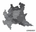
Lombardy Region Map Vector Illustration
Download
Designed by
Photoimgvect
Title
Lombardy region map #183573274
Description
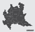
The dark silhouette map of Lombardy region on white background
Italy 3d black and orange map, with Lombardy region highlighted.
Lombardy region watercolor map of Italy in front of a white back
Satellite view of the Lombardy region. Italy. 3d render. Physical map of Lombardy
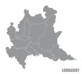
Lombardy region map
Spectrum Pattern Map of Lombardy Region for LGBT
Lombardy region map
Lombardy region map
Covid Virus Hole Circle Map of Lombardy Region Mosaic
Mosaic Hole and Solid Map of Lombardy Region
Autumn Leaves - Mosaic Map of Lombardy Region
Carcass Polygonal Map of Lombardy Region with Red Stars
Vector Spectrum Gradient Dotted Map of Lombardy Region
Net Map of Lombardy Region with Spectrum Gradient
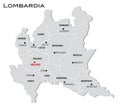
Simple gray administrative map of Lombardy region of Italy
Lombardy region entrance road sign in Italy