Search
(+)
cartoon
dealer
buy stock illustrations
Home
My rookie portfolio
📷 Upload yours 🤳
Find results that contain
all
of your keywords. Content filter is
on
. Search will return
best illustrations, stock vectors and clipart
.
Exclude
Make it so!
You have chosen to exclude "
" from your results.
Choose orientation:
Explore cartoons & images using related keywords:
administration
administrative
america
aurora
background
belleville
border
brown
cambridge
champaign
chicago
city
color
colored
country
county
crystal
cut
decatur
dekalb
design
digital
geography
graphic
illinois
illustration
indiana
iowa
kentucky
lake
louis
map
michigan
missouri
nation
outline
political
river
shape
sign
springfield
state
states
symbol
towns
united
usa
vector
wisconsin
Illinois Counties Map Stock Image
Download
Designed by
Photoimgvect
Title
Illinois counties map #187184161
Description
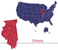
The Illinois State counties map isolated on dark background
Illinois map
Illinois State map
Illinois counties vector map
Illinois counties map
Illinois counties icons.
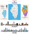
Illinois counties map. State\'s capital city (Springfield) and Chicago (state\'s largest city)
Illinois administrative map. counties map of Illinois with black, blank Map, empty map of Illinois
Illinois administrative map. counties map of Illinois with different colours, blank Map, empty map of Illinois
Illinois administrative map. counties map of Illinois with black color, blank Map, empty map of Illinois
Illinois, U.S. state subdivided into 102 counties, political map
Illinois, U.S. state subdivided into 102 counties, gray political map