Find results that contain all of your keywords. Content filter is on.
Search will return best illustrations, stock vectors and clipart.
Choose orientation:
Make it so!
You have chosen to exclude "" from your results.
Choose orientation:
Explore cartoons & images using related keywords:
administrative
area
boroughs
britain
business
camden
capital
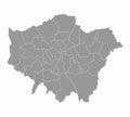
cartography center chelsea city detailed district ealing enfield england famous fulham geography greater greenwich guide hackney hamlets hammersmith harrow hounslow illustration islington kensington kingdom london map neighborhood newham place plan richmond southwark sutton thames tourism tower town travel union united vector westminsterLondon Regions Map Royalty-Free Stock Photo
Designed by
Title
London regions map #187184235
Description


