Search
(+)
cartoon
dealer
buy stock illustrations
Home
My rookie portfolio
📷 Upload yours 🤳
Find results that contain
all
of your keywords. Content filter is
on
. Search will return
best illustrations, stock vectors and clipart
.
Exclude
Make it so!
You have chosen to exclude "
" from your results.
Choose orientation:
Explore cartoons & images using related keywords:
satellite
earth
aerial
gis
view
image
sensing
observation
map
imagery
remote
desert
landsat
picture
above
agricultural
agriculture
air
artificial
automation
background
business
computer
concept
control
countryside
crop
crops
cultivated
data
digital
farm
farmer
farming
farmland
field
future
green
growth
harvest
harvesting
innovation
intelligence
land
landmark
landscape
leaf
machine
monitoring
natural
Satellite Image Where Crops Are Seen Over The Sonora Desert, Mexico.
Download
Designed by
Asvmagz
Title
Satellite image where crops are seen over the sonora desert, mexico. #189302455
Description
Satellite image where crops are seen over the sonora desert, mexico. Images generated from copernicus images.
Europe Continent Satellite Space View
Middle East - High resolution map
Weather satellite for observing powerful thunderstorms of storms and tornadoes in space orbiting the earth. Elements of this image
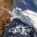
Bushfire places in Australia map. Satellite image
Earth flat view from space. Detailed World physical map on global satellite photo
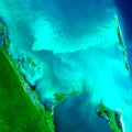
Satellite image of city of Cancun, Quintana Roo, Mexico.
Satellite image where crops are seen over the sonora desert, mexico.
Earth from space at night. View from satellite orbit to the lights of cities in Europe, the Middle East and North Africa on the
Top view of Great Lakes satellite image. Elements of this image furnished by NASA
Satellite Image of Powerful Ocean Storm
High-Resolution Satellite Image of Desert Storm