Search
(+)
cartoon
dealer
buy stock illustrations
Home
My rookie portfolio
📷 Upload yours 🤳
Find results that contain
all
of your keywords. Content filter is
on
. Search will return
best illustrations, stock vectors and clipart
.
Exclude
Make it so!
You have chosen to exclude "
" from your results.
Choose orientation:
Explore cartoons & images using related keywords:
map
japanese
regions
prefectures
asian
black
colored
contour
country
dark
districts
east
eastern
flat
government
governorates
grey
hokkaido
illustration
imperial
israel
japan
labeled
location
middle
pastel
provinces
region
relief
seal
tehran
topography
vector
white
Map Of Japanese Regions Vector Illustration
Download
Designed by
Momcilojovanov
Title
Map of Japanese Regions #191304582
Description
Pastel Colored Flat Regions Map of Asian Country of Japan
Wavy background with Japanese traditional design.
Hand drawn japanese meiji-jingu scene
Hand drawn japanese multi-storey pagoda scene
Hand drawn japanese multi-store pagoda scene
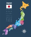
Japan prefectures vector map colored be regions. Japanese names gives in parentheses. Flag of Japan
Vector illustration of Japanese flag and prefectures map colored by regions. Largest city skylines
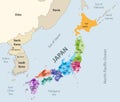
Japan prefectures vector map colored be regions with neighbouring countries and territories
Japanese low poly regions.
Map of Japan administrative regions departments, icons. Map location pin, arrow, man, bicycle, car, airplane
The illustration showcases a group of Japanese individuals, reflecting the diversity and beauty of the Japanese people
Japanese-style Landscape: Man Walking In Wheat Field
Hannan City Map, black and white outline regions of the Japanese country. Vector illustration colorful design
Vector Map of Japan. map of the provinces of Japan. Regions of Japan. Vector map of Japanese regions with neighbouring countries
Regions of Japan, multi colored political map over black
Stunning Aerial Perspective of Japan and Thailand Flags A DronesEye View of Southeast Asian Nations