Search
(+)
cartoon
dealer
buy stock illustrations
Home
My rookie portfolio
📷 Upload yours 🤳
Find results that contain
all
of your keywords. Content filter is
on
. Search will return
best illustrations, stock vectors and clipart
.
Exclude
Make it so!
You have chosen to exclude "
" from your results.
Choose orientation:
Explore cartoons & images using related keywords:
abstract
africa
alexandria
ancient
art
asia
background
blue
border
cairo
capital
cartography
cities
city
concept
continent
contour
country
desert
design
destination
drawn
egypt
egyptian
geography
giza
graphic
hand
icon
illustration
isolated
land
map
mediterranean
nation
national
nile
north
outline
red
region
republic
rivers
roads
sea
shape
sign
sinai
state
suez
Egypt Map, Rivers, Roads And Cities Royalty-Free Stock Image
Download
Designed by
Vampy1
Title
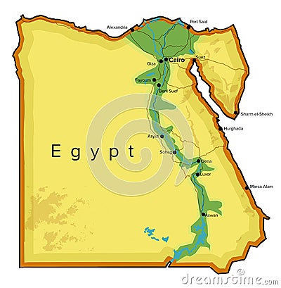
Egypt map, rivers, roads and cities #193625446
Description
Egypt map, rivers, roads and cities. Hand drawn map. North Africa cartography.
Map of Egypt
Contour map of Egypt with shape of some rivers. Simplicity icon in linear style
Ancient Egypt Map
World Map of MEDITERRANEAN REGION: Southern Europe, Middle East, North Africa. (Geographic chart).
World Map of AFRICA: Egypt, Libya, Ethiopia, Arabia, Mauritania, Nigeria, Somalia. Geographic XXL-chart.
Satellite map of Governorates of Egypt, Cairo Governorate, Giza and Monufia Governorate
Egypt vintage poster illustration design with pyramid and nile rivers background design
Layered editable vector streetmap of Cairo,Egypt
Physical map of the country of Egypt colored
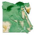
Egypt relief map
Detailed editable vector map of Egypt on Arab language
Detailed editable vector map of Egypt on English language
Detailed editable vector map of Egypt on French language