Find results that contain all of your keywords. Content filter is on.
Search will return best illustrations, stock vectors and clipart.
Choose orientation:
Make it so!
You have chosen to exclude "" from your results.
Choose orientation:
Explore cartoons & images using related keywords:
abstract
administrative
aleppo
arab
arabic
asia
atlas
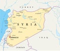
background blue border cartography cities city color concept continent contour country damascus design drawn east geography graphic hand icon illustration iraq land location map mapping mediterranean middle nation national outline political politics region rivers roads sea shape state symbol syria syrian territory topographySyria Map, Rivers, Roads And Cities. Stock Photo
Designed by
Title
Syria map, rivers, roads and cities. #193872246
Description


