Search
(+)
cartoon
dealer
buy stock illustrations
Home
My rookie portfolio
📷 Upload yours 🤳
Find results that contain
all
of your keywords. Content filter is
on
. Search will return
best illustrations, stock vectors and clipart
.
Exclude
Make it so!
You have chosen to exclude "
" from your results.
Choose orientation:
Explore cartoons & images using related keywords:
abstract
africa
border
bright
cartography
clean
collection
color
colorful
concept
country
creative
curve
decoration
design
digital
element
flag
flow
geography
geometric
gradient
graphic
illustration
infographic
juba
kit
landmark
line
liquid
map
multicolored
set
shape
smooth
south
style
sudan
sudanese
symbol
technology
template
travel
vector
vibrant
water
waves
wavy
world
Set Of Vector Maps Of South Sudan.
Download
Designed by
Gagarych
Title
Set of vector maps of South Sudan. #197040677
Description
Set of vector maps of South Sudan. Vibrant waves design. Bright map of country in geometric smooth curves style. Multicolored South Sudan map for your design. Superb vector illustration.
Europe vector map
Vector world map
World map with countries
World Globe Maps
Countries Names Vector Maps Africa Silhouette
Vector maps of Western Europe with capitals
Vintage world map. Retro countries boundaries on topographic or marine map. Old continents navigation maps vector
Polygonal map. Digital globe map, blue polygons earth maps and world internet connection 3d grid vector concept
Vector maps set. High detailed 45 maps of European countries with administrative division and cities. Political map, map of
Colored world map. Political maps, colourful world countries and country names vector illustration
Terrain map. Contours trails, image grid geographic relief topographic contour line maps cartography texture, vector
GPS icon vector logo design. Map pointer icon. Pin location symbol
Seven different abstract topographic and castral vector maps
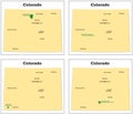
Four small vector maps of the Colorado National Parks
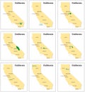
Nine small vector maps of Californias national parks
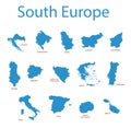
South europe - vector maps of territories