Search
(+)
cartoon
dealer
buy stock illustrations
Home
My rookie portfolio
📷 Upload yours 🤳
Find results that contain
all
of your keywords. Content filter is
on
. Search will return
best illustrations, stock vectors and clipart
.
Exclude
Make it so!
You have chosen to exclude "
" from your results.
Choose orientation:
Explore cartoons & images using related keywords:
antique
cartography
chart
countries
country
detail
document
domain
drawing
geography
illustration
land
latitude
longitude
map
old
public
regions
vintage
world
Antique Map Of The Atlantic Ocean Royalty-Free Stock Photography
Download
Designed by
Cascoly
Title
Antique map of the Atlantic Ocean #197129327
Description
Antique map of the Atlantic Ocean from the out of print 1841 Goodrich atlas
Antique map of the Atlantic Ocean
Tuna Bluefin atlantic Thynnus old Antique illustration from Brockhaus Konversations-Lexikon 1908
Herring atlantic clupea harengus old Antique illustration from Brockhaus Konversations-Lexikon 1908
Atlantic mackerel, scomber scombrus, an important migratory food fish in side view
Shell of the Atlantic triton, charonia variegata
Strange-looking sargassum fish, anglerfish or frog fish, histrio from the atlantic ocean
Endangered Atlantic bluefin tuna or tunny, thunnus, an important food fish in side view
Brazilian batfish or seadevil, ogcocephalus vespertilio from the atlantic ocean
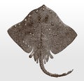
Threatened thorny skate amblyraja radiata, marine fish from the Atlantic Ocean in top view
Threatened common smooth-hound, mustelus, a shark from the eastern Atlantic Ocean and the Mediterranean Sea in side view
Threatened diamondback terrapin, malaclemys, a turtle from the North American Atlantic coast in top view
Threatened Atlantic puffin, fratercula arctica in side view sitting on a cliff by the sea
Octopus verrucosus from the Southeast Atlantic Ocean in top view
Atlantic bumper I Antique Animal Illustrations
Antique map of the Atlantic Ocean