Search
(+)
cartoon
dealer
buy stock illustrations
Home
My rookie portfolio
📷 Upload yours 🤳
Find results that contain
all
of your keywords. Content filter is
on
. Search will return
best illustrations, stock vectors and clipart
.
Exclude
Make it so!
You have chosen to exclude "
" from your results.
Choose orientation:
Explore cartoons & images using related keywords:
administrative
art
border
canada
cartography
chart
city
concept
contour
country
county
cut
dark
detailed
district
division
famous
geography
government
graphic
greater
grey
guide
icon
illustration
isolated
line
map
mapping
nation
national
ontario
outline
plan
political
province
reading
region
royal
shape
sub
symbol
texture
toronto
town
travel
vector
white
world
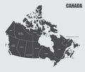
Canada Provinces Map Cartoon Vector
Download
Designed by
Photoimgvect
Title
Canada provinces map #197476307
Description
The Canada provinces map isolated on dark background
USA and Canada large detailed political map with states, provinces and capital cities
3d waving flag of Yukon
3d waving flag of Quebec
3d waving flag of Nova Scotia, silk texture fabric
3d waving flag of Alberta
3d waving flag of Yukon
3d waving flag of Nova Scotia
Canada All Provinces & Territories Flag Vector Illustration on White Background. Flags of Canada
Set of canada provinces and territories icons
Map of North America. Detailed map of North America with States of the USA and Provinces of Canada. Template.
Canada provinces map
Canada Provinces and Territories Flags Collection Design Template