Search
(+)
cartoon
dealer
buy stock illustrations
Home
My rookie portfolio
📷 Upload yours 🤳
Find results that contain
all
of your keywords. Content filter is
on
. Search will return
best illustrations, stock vectors and clipart
.
Exclude
Make it so!
You have chosen to exclude "
" from your results.
Choose orientation:
Explore cartoons & images using related keywords:
administrative
background
bavaria
berlin
border
bremen
capital
cartography
concept
contour
country
digital
europe
european
federal
geographic
geography
german
germany
graphic
hamburg
illustration
infographic
isolated
map
munich
nation
national
outline
political
region
republic
saxony
shape
silhouette
state
states
symbol
tourism
travel
vector
white
worldwide
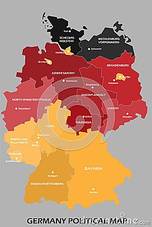
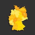
Germany Political Map Divide By State Colorful Outline Simplicity Style Vector Illustration
Download
Designed by
Tanarch
Title
Germany political map divide by state colorful outline simplicity style #200735276
Description
Germany political map divide by state colorful outline simplicity style. Vector illustration
Germany political map gray colored
Germany Political Map
Germany political map card paper 3D natural
Colorful Germany political map with clearly labeled, separated layers.
Germany - political map, red country shape, borders
Germany political map divide by state colorful outline simplicity style
Isometric 3D map of Germany. Political country map in perspective with administrative divisions and pointer marks. Detailed map of
Germany political map. Low detailed
Ruegen or Rugia, the largest island of Germany, political map
Germany political map of administrative divisions
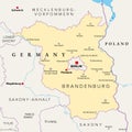
Brandenburg, a state in northeastern Germany, political map
Saxony, a state in Germany, political map with capital Dresden