Search
(+)
cartoon
dealer
buy stock illustrations
Home
My rookie portfolio
📷 Upload yours 🤳
Find results that contain
all
of your keywords. Content filter is
on
. Search will return
best illustrations, stock vectors and clipart
.
Exclude
Make it so!
You have chosen to exclude "
" from your results.
Choose orientation:
Explore cartoons & images using related keywords:
america
background
business
canada
capital
chart
communication
concept
country
cuba
diagram
divided
economic
flag
geography
graphic
guatemala
honduras
illustration
infodata
infographic
information
label
map
market
mexico
nation
national
nicaragua
panama
presentation
project
provinces
regions
slide
statistic
structure
tag
template
tourism
travel
usa
vector
visualization
world
North And Central America Vector Map Infographics. USA, Canada, Mexico. 12 Slide Presentation Templates. World
Download
Designed by
Theseamuss
Title
North and Central America vector map infographics. USA, Canada, Mexico. 12 slide presentation templates. World #200784045
Description
Vector map infographic templates pack
Earth from space with North, Central and South America
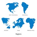
Detailed vector map of North - Central America, Asia Pacific, Europe, South America, Middle and East Africa Regions
Vector posters with highly detailed silhouettes of maps of the states of America, Division West North Central - Kansas, Iowa,
Vector posters with highly detailed silhouettes of maps of the states of America, Division West North Central - North Dakota,
Vector posters with highly detailed silhouettes of maps of the states of America, Division East North Central - Illinois, Indiana
Vector posters detailed silhouettes maps of the states of America with abstract linear pattern, Division West North Central -
Vector posters states of the United States with a name, nickname, date admitted to the Union, Division East North Central -
Vector posters states of the United States with a name, nickname, date admitted to the Union, Division West North Central - Kansas
Vector posters detailed silhouettes maps of the states of America with abstract linear pattern, Division East North Central -
East North Central states in the Midwest region of USA, gray political map
West North Central states in the Midwest region of USA, gray political map
East North Central states in the Midwest region of USA, colored political map
West North Central states in the Midwest region of USA, multi colored map
Amazing clouds and fall colors in autumn on the Icicle River in North Central Washington Creative AI