Search
(+)
cartoon
dealer
buy stock illustrations
Home
My rookie portfolio
📷 Upload yours 🤳
Find results that contain
all
of your keywords. Content filter is
on
. Search will return
best illustrations, stock vectors and clipart
.
Exclude
Make it so!
You have chosen to exclude "
" from your results.
Choose orientation:
Explore cartoons & images using related keywords:
administrative
atlas
background
baltic
bitmap
border
bornholm
cartography
central
colorful
continent
copenhagen
country
culture
denmark
design
destination
detailed
education
europe
faroe
finland
flag
flags
geography
gotland
helsinki
iceland
icon
illustration
islands
lakes
land
lapland
map
nation
national
nordic
north
norway
ocean
oslo
region
reykjavashy
scandinavia
sea
silhouettes
simplified
stockholm
sweden
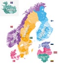
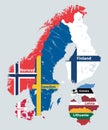
Detailed Map Of Scandinavia With Country Silhouettes And Flags Vector Illustration
Download
Designed by
Kkorneeva44
Title
Detailed map of Scandinavia with country silhouettes and flags #203082104
Description
Detailed map of Scandinavia with country silhouettes and flags, for your design
Detailed Earth. Europe. Scandinavia
Scandinavia-physical map
Detailed Earth. Europe. Scandinavia on a moonlit night
Detailed Earth at night. Europe. Scandinavia
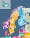
Scandinavia and Baltic countries political detailed map. Vector illustration
Detailed Earth. Europe. Scandinavia
Detailed editable vector map of Scandinavia on German language
Detailed editable vector map of Scandinavia on Danish language
Detailed editable vector map of Scandinavia on English language
Detailed editable vector map of Scandinavia on Finnish language
Detailed editable vector map of Scandinavia on Norwegian language
Detailed editable vector map of Scandinavia on Chinese language