Search
(+)
cartoon
dealer
buy stock illustrations
Home
My rookie portfolio
📷 Upload yours 🤳
Find results that contain
all
of your keywords. Content filter is
on
. Search will return
best illustrations, stock vectors and clipart
.
Exclude
Make it so!
You have chosen to exclude "
" from your results.
Choose orientation:
Explore cartoons & images using related keywords:
1859
america
americas
argentina
atlantic
atlas
background
banner
bolivia
borders
brazil
brown
canada
cartography
chile
city
contemporary
continent
continents
countries
country
design
detailed
earth
education
geography
globe
graphic
grunge
illustration
land
map
north
ocean
old
pacific
paper
paraguay
planet
political
retro
river
sea
shows
south
symbol
travel
venezuela
vintage
wall
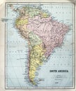
Old Map Of South America From 1859. The Map Shows The Contemporary Borders Of The Countries / Vintage Style Stock Photography
Download
Designed by
Rochu2008
Title
Old map of South America from 1859. The map shows the contemporary borders of the Countries / Vintage style #203491298
Description
Old map of South America from 1859. The map shows the contemporary borders of the Countries.
Globe (South America)
Map South America - vector - detailed
Scenic landscape in Patagonia, South America
Antique Map of South America
Panorama of Mysterious city - Machu Picchu, Peru, South America. The Incan ruins.
south America map on a globe
Map of South America
Satellite view of the Amazon, map, states of South America, reliefs and plains, physical map
Earth globe isolated on whitebackground. Satellite view focused on South America. Elements of this image furnished by
Detailed Earth. South America. Rio de La Plata on a moonlit night
Close up of cute and funny Alpacas, Andes of Bolivia, South America
Retro map of South America with a magnifying glass and a green point marking Brazil
Aerial view of Amazon rainforest in Brazil, South America. Green forest. Bird`s-eye view
Earth planet. Globe. View of North and South America.