Search
(+)
cartoon
dealer
buy stock illustrations
Home
My rookie portfolio
📷 Upload yours 🤳
Find results that contain
all
of your keywords. Content filter is
on
. Search will return
best illustrations, stock vectors and clipart
.
Exclude
Make it so!
You have chosen to exclude "
" from your results.
Choose orientation:
Explore cartoons & images using related keywords:
abstract
america
american
art
atlas
blue
border
cartography
city
country
detailed
drawing
earth
editable
graphic
hawaii
hawaiian
hilo
honolulu
island
kauai
kaunakakai
kekaha
land
map
mapping
modern
molokai
nation
national
new
oahu
ocean
outline
pacific
polynesia
red
sea
space
state
symbol
topographic
travel
united
usa
vector
volcano
white
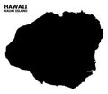
Kauai Island Detailed Editable Map Cartoon Vector
Download
Designed by
Olira
Title
Kauai island detailed editable map #204186317
Description
Kauai island detailed editable map with cities and towns, geographic sites, roads, interstates and U.S. highways. Vector EPS-10 file, trending color scheme
Kauai Island. United States. Location diagram. Yellow
Kauai Island. United States. Shape on white. Bilevel
Kauai Island. United States. Topo Humanitarian
Kauai Island. United States. Physical
Kauai Island. United States. Shape on white. Topo standard
Kauai Island, United States, cropped to square. Topo standard
Kauai Island, United States, cropped to square. Physical
Shape of Kauai Island. United States. Yellow
Kauai Island, United States, highlighted and labelled. Bilevel
Kauai Island. United States. Bilevel
Kauai Island, United States, cropped to square. Topo Humanitarian
Kauai Island, United States, cropped to square. Bilevel
Kauai Island. United States. Topo standard
Kauai Island. United States. Shape on white. Physical