Search
(+)
cartoon
dealer
buy stock illustrations
Home
My rookie portfolio
📷 Upload yours 🤳
Find results that contain
all
of your keywords. Content filter is
on
. Search will return
best illustrations, stock vectors and clipart
.
Exclude
Make it so!
You have chosen to exclude "
" from your results.
Choose orientation:
Explore cartoons & images using related keywords:
america
american
arkansas
atlas
border
boundary
cartographic
cartography
city
columbia
country
digital
fill
geography
graphic
highways
illustration
interstate
iowa
jefferson
kansas
kentucky
lake
louis
map
mapping
mississippi
missouri
nation
national
nebraska
north
oklahoma
outline
red
river
road
silhouette
springfield
state
tennessee
towns
travel
united
usa
vector
Missouri State Detailed Editable Map Vector Illustration
Download
Designed by
Olira
Title
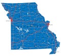
Missouri state detailed editable map #204191018
Description
Missouri state detailed editable map with cities and towns, geographic sites, roads, railways, interstates and U.S. highways. Vector EPS-10 file, trending color scheme
Missouri State Interstate Map
Map of the U.S. state Missouri
Missouri State Capitol in Jefferson City
Hand Drawn Missouri State Design
Missouri State Shape with Farm at Sunset w Windmill, Barn, and a
Missouri state outline administrative and political vector map in black and white
Missouri, state of USA - solid black silhouette map of country area. Simple flat vector illustration
Missouri, state of USA - solid black outline map of country area. Simple flat vector illustration
Missouri state political map
Missouri State Highway road sign
Missouri MO State Border USA Map Outline
Doodle vector map of Missouri state of USA
Missouri eps
Missouri state skyline and landmarks silhouette
Missouri state stamp with seal, USA travel stamp, shabby postmark of Missouri