Search
(+)
cartoon
dealer
buy stock illustrations
Home
My rookie portfolio
📷 Upload yours 🤳
Find results that contain
all
of your keywords. Content filter is
on
. Search will return
best illustrations, stock vectors and clipart
.
Exclude
Make it so!
You have chosen to exclude "
" from your results.
Choose orientation:
Explore cartoons & images using related keywords:
abstract
administrative
area
atlas
background
banner
black
boaco
border
borders
carazo
cartography
celebration
chinandega
chontales
city
color
concept
contour
country
department
departments
design
detailed
estelí
flag
geography
granada
graphic
gray
icon
illustration
inside
isolated
its
jinotega
land
león
location
map
names
nation
national
nationality
nicaragua
nicaraguan
official
outline
pastel
patriot
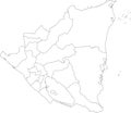
White Map Of Nicaragua Vector Illustration
Download
Designed by
Momcilojovanov
Title
White map of Nicaragua #206273386
Description
White vector map of Nicaragua with black borders and names of it`s departments
Nation flag - Airplane isolated - Nicaragua
Managua Nicaragua City Skyline Black and White Silhouette with R
Managua Nicaragua Skyline with Gray Buildings Isolated on White.
Managua Nicaragua City Skyline Silhouette with Golden Buildings Isolated on White
Managua Nicaragua Skyline with Gray Buildings and Reflections Isolated on White
Outline Managua Nicaragua City Skyline with White Buildings
Gray icon with white silhouette of a map Nicaragua
Soccer ball in flag colors isolated on white background. Nicaragua
Outline Managua Nicaragua, Tegucigalpa Honduras and San Jose Costa Rica City Skyline with White Buildings
White map of Nicaragua
A large group of people are standing in blue, white and yellow robes, symbolizing the flag of Nicaragua
Abstract polygonal background in the form of colorful blue and white stripes of the Nicoaguacan flag. Polygonal flag of Nicaragua
Managua Nicaragua city Skyline with Color Buildings isolated on white
Blue Nicaragua 3d map with pointer pin surrounded with other countries in white. Europe political map with borders. 3d