Search
(+)
cartoon
dealer
buy stock illustrations
Home
My rookie portfolio
📷 Upload yours 🤳
Find results that contain
all
of your keywords. Content filter is
on
. Search will return
best illustrations, stock vectors and clipart
.
Exclude
Make it so!
You have chosen to exclude "
" from your results.
Choose orientation:
Explore cartoons & images using related keywords:
abstract
administrative
area
arms
art
austria
background
banner
beige
black
border
capital
cartography
city
coat
concept
contour
country
cuando
cubango
decorative
design
detailed
district
drawing
earth
element
emblem
europe
geography
graphic
hietzing
icon
illustration
location
logo
map
mapping
modern
national
neighbourhood
outline
penzing
political
province
region
roads
shape
sign
silhouette
Street Roads Map Of The Mariahilf District Of Vienna, Austria Vector Illustration
Download
Designed by
Momcilojovanov
Title
Street roads map of the Mariahilf district of Vienna, Austria #209622872
Description
Black simple detailed street roads map on vintage beige background of the neighbourhood Mariahilf district of Vienna, Austria
Street map of town
Roads in perspective. Bended pathway road curved city street to horizon. Journey asphalt highway isolated vector
Street roads vector icon
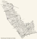
Street roads map of the Royal Borough of Kensington and Chelsea, London
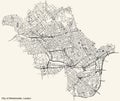
Street roads map of the London Borough City of Westminster
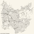
Street roads map of the London Borough of Redbridge
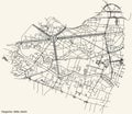
Street roads map of the Tiergarten locality of the Mitte borough
Street roads map of the Municipio VI ââ¬â Roma Delle Torri municipality of Rome Italy
Street roads map of the sixième, 6th arrondissement of Paris, France
Street roads map of the Stadtbezirk 9 district of Düsseldorf, Germany
Street roads map of the Centro district of Malaga, Spain
Street roads map of the Postal district 8 D8 of Dublin, Ireland
Street roads map of Bologna, Italy
Street roads map of Galway City, Ireland