Search
(+)
cartoon
dealer
buy stock illustrations
Home
My rookie portfolio
📷 Upload yours 🤳
Find results that contain
all
of your keywords. Content filter is
on
. Search will return
best illustrations, stock vectors and clipart
.
Exclude
Make it so!
You have chosen to exclude "
" from your results.
Choose orientation:
Explore cartoons & images using related keywords:
16th
abstract
administrative
arms
art
atlas
background
banner
border
budapest
cartography
cinkota
city
coat
country
crown
design
district
earth
emblem
ensign
europe
european
flag
geography
global
graphic
heraldic
heraldry
hungar
hungarian
hungary
illustration
information
insignia
kerület
location
map
national
neighbourhood
political
region
road
roads
sashalom
state
street
symbol
symbolic
technology
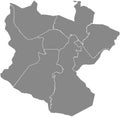
Gray Map Of Districts Kerület Of Budapest, Hungary Vector Illustration
Download
Designed by
Momcilojovanov
Title
Gray map of districts kerület of Budapest, Hungary #210905984
Description
Simple gray vector map with white borders of districts kerület of Budapest, Hungary
Blank gray districts map of Florence, Italy
Blank gray districts map of Bilbao, Spain
Blank gray districts map of Lublin, Poland
Blank gray districts map of Karlsruhe, Germany
Blank gray districts map of Mannheim, Germany
Blank gray districts map of Amsterdam, Netherlands
Blank gray districts map of Copenhagen Municipality, Denmark
Blank gray districts map of Zurich, Switzerland
Blank gray districts map of Geneva, Switzerland
Blank gray districts map of Basel, Switzerland
Blank gray districts map of Biel-Bienne, Switzerland
Gray districts map of REYKJAVIK, ICELAND
Gray districts map of CHEMNITZ, GERMANY
Gray districts map of ROSTOCK, GERMANY
Gray districts map of KASSEL, GERMANY
Gray districts map of BOTTROP, GERMANY