Search
(+)
cartoon
dealer
buy stock illustrations
Home
My rookie portfolio
📷 Upload yours 🤳
Find results that contain
all
of your keywords. Content filter is
on
. Search will return
best illustrations, stock vectors and clipart
.
Exclude
Make it so!
You have chosen to exclude "
" from your results.
Choose orientation:
Explore cartoons & images using related keywords:
america
american
background
badge
beautiful
black
border
boundary
card
chart
circle
concept
contour
counties
country
decorative
destination
geo
geography
globe
gps
icon
illustration
image
indiana
infographics
isolated
landmark
map
navigation
north
northern
outline
round
shape
sign
silhouette
state
symbol
territory
topography
travel
united
unusual
usa
vector
world
Indiana Counties Icons. Vector Illustration
Download
Designed by
Gagarych
Title
Indiana counties icons. #212333578
Description
Indiana counties icons. Black round logos with us state counties maps and titles. Vector illustration.
Indiana State map by counties
Indiana counties vector map
Pastel counties map of Indiana, USA
The state of Indiana is seen as a pastel patchwork of individual counties with a star for the capital
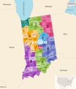
Indiana state counties colored by congressional districts vector map with neighbouring states and terrotories
Map of Indiana state, USA. Set of Indiana maps with outline border, counties and US states map. Black and white color
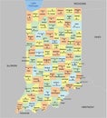
Indiana County Map with 92 counties
Indiana\'s counties map. Indianapolis skyline (state\'s capital and most populous city)
Modern Dynamic White Map of Indiana with Counties
Indiana state map with counties borders and colored congressional districts boundaries
Indiana, U.S. state, subdivided into 92 counties, political map
Indiana, U.S. state, subdivided into 92 counties, gray political map